


The earth beneath our feet is a dynamic, ever-shifting entity, capable of unleashing forces beyond human comprehension. Among these, the tandem threat of earthquakes and tsunamis stands as one of the most devastating. From the sudden, violent jolt of the ground to the relentless, towering waves that can engulf coastlines, these natural phenomena demand our utmost respect and preparedness. While we cannot prevent them, advancements in science and technology have empowered us with crucial tools: earthquake and tsunami warnings. These systems, constantly evolving, are our first line of defense, offering precious minutes or even hours that can mean the difference between life and death.
This article delves deep into the world of earthquake and tsunami warnings, exploring their intricate workings, their historical journey, cutting-edge innovations, and most importantly, how you, as an individual and part of a community, can leverage this knowledge to ensure your safety. earthquake and tsunami warnings
The Science Behind the Earthquake and Tsunami Warnings: How Do They Work?
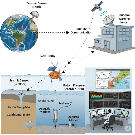
At its core, an earthquake tsunami warning system is a sophisticated network designed to detect seismic activity and sea-level changes, then rapidly disseminate information to at-risk populations. It’s a race against time, where every second counts.
1. Seismic Detection: The First Tremor. The journey of a tsunami warning often begins with an earthquake. Specialized seismic sensors, deployed globally on land and increasingly underwater, continuously monitor ground vibrations. When an earthquake occurs, these sensors detect the seismic waves:
- P-waves (Primary Waves): These are the fastest seismic waves, traveling through the Earth’s interior and causing a compression-and-expansion motion. They are typically less destructive but arrive first, providing the initial alert.
- S-waves (Secondary Waves): These are slower than P-waves but cause more significant shaking.
- Surface Waves: These are the slowest but often the most destructive, traveling along the Earth’s surface.
Upon detecting an earthquake, real-time data from these sensors is transmitted to tsunami warning centers. Scientists analyze the earthquake’s magnitude, location, and depth. A critical factor for tsunami generation is the earthquake’s location (underwater or near coastal areas) and its ability to cause significant vertical displacement of the seafloor. This displacement is what displaces the water column and initiates earthquake and tsunami warnings.
2. Sea-Level Monitoring: Confirming the Threat While an earthquake might be the trigger, it’s the subsequent ocean disturbance that confirms a tsunami. This is where sea-level monitoring comes into play.
- DART Buoys (Deep-ocean Assessment and Reporting of Tsunamis): These are perhaps the most iconic components of a tsunami warning system. DART buoys consist of a bottom pressure recorder (BPR) on the seafloor that detects minute changes in water pressure caused by passing tsunami waves. This data is then transmitted to a surface buoy, which relays it via satellite to warning centers.
- Coastal Tide Gauges: These instruments measure local sea-level fluctuations along coastlines. While they detect the tsunami closer to shore, they are crucial for confirming the arrival and magnitude of the waves in real-time for specific locations.
3. Data Analysis and Modeling: Predicting the Unpredictable Once seismic and sea-level data are received, scientists at warning centers rapidly process the information. Sophisticated computer models are used to:
- Estimate Tsunami Generation: Based on the earthquake’s characteristics, models predict the likelihood of a tsunami being generated.
- Forecast Tsunami Travel Times: Tsunami waves travel across oceans at incredible speeds, comparable to a jet plane (up to 800 km/h or 500 mph in the deep ocean). Models calculate arrival times for various coastal regions.
- Predict Wave Heights: While challenging, models also attempt to estimate the potential wave heights and inundation levels at different locations, considering local bathymetry and topography.
4. Dissemination of Warnings: The Urgent Call to Action Once a potential or confirmed tsunami threat is identified, the warning centers issue alerts. These alerts typically come in different tiers:
- Tsunami Watch: Issued when a potential tsunami-generating earthquake has occurred, indicating that a tsunami is possible. This gives coastal communities time to prepare.
- Tsunami Advisory: Indicates possible strong waves or currents. Flooding is possible but less likely to be widespread. Advises people to stay out of the water and off beaches.
- Tsunami Warning: The highest level of alert, issued when a dangerous tsunami is imminent or expected. This demands immediate evacuation to higher ground.
These earthquake and tsunami warnings are disseminated through various channels:
- Emergency Alert Systems (TV, radio)
- Wireless Emergency Alerts (WEA) to mobile phones
- Social media
- Local sirens
- Community officials and first responders
The goal is to reach as many people as possible, as quickly as possible, enabling timely evacuation and saving lives.
A Look Back: The Evolution of Warning Systems
The concept of a formalized tsunami warning system is relatively recent, born out of devastating events that underscored the need for global cooperation.
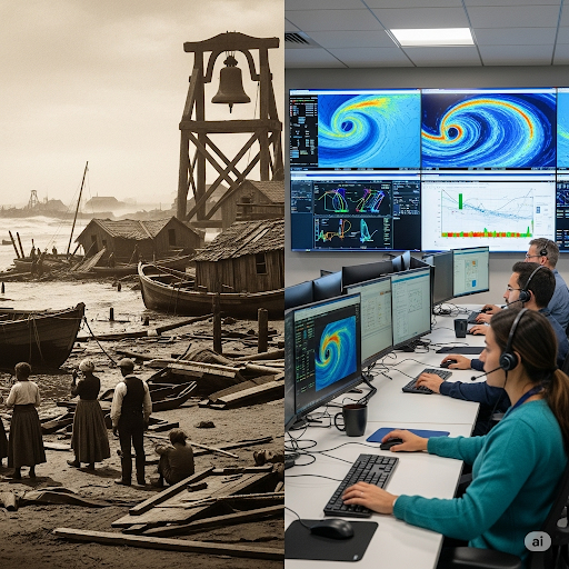
Before the mid-20th century, communities often had little to no warning of impending tsunamis. Local knowledge, such as the sudden receding of the ocean, was sometimes the only indicator. The devastating 1946 Aleutian Islands earthquake and tsunami, which caused significant damage and loss of life in Hawaii, spurred the establishment of the Pacific Tsunami Warning Center (PTWC) in 1949. This marked the beginning of a coordinated international effort.
The 1960 Great Chilean Earthquake, which generated a Pacific-wide tsunami affecting Hawaii, Japan, and other nations, further highlighted the need for a robust, international system. This led to the formation of the Intergovernmental Coordination Group for the Pacific Tsunami Warning System (ICG/PTWS) under UNESCO’s Intergovernmental Oceanographic Commission (IOC) in 1965.
While significant progress was made in the Pacific, other regions lagged. The tragic 2004 Indian Ocean Tsunami, which claimed over 230,000 lives across 14 countries, served as a grim wake-up call for the entire world. It exposed critical gaps in warning infrastructure and public awareness, particularly in the Indian Ocean region. In its aftermath, a global push led to the development of similar warning systems in the Indian Ocean, Caribbean Sea, and Mediterranean Sea.
Today, UNESCO’s IOC coordinates the global tsunami warning system, building upon the lessons learned from decades of experience and disaster.
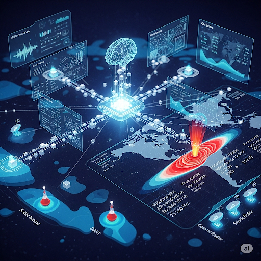
The Cutting Edge: Latest Advancements in Warning Technology
The field of earthquake and tsunami warnings is a dynamic area of research and technological innovation. Scientists and engineers are constantly striving to improve the speed, accuracy, and reach of these vital systems.
1. Enhanced Seismic Networks:
- Dense Sensor Arrays: Greater density of seismic sensors, including those on the seafloor, provides more precise and rapid earthquake detection and characterization.
- Real-time Data Transmission: Improvements in satellite communication and undersea cables ensure faster data flow from remote sensors to warning centers.
2. Next-Generation Ocean Monitoring:
- Advanced DART Buoys: Newer DART buoy designs offer improved stability, accuracy, and data transmission capabilities.
- Coastal Radar Systems: These systems can monitor subtle changes in ocean surface height near the coastline, providing additional real-time data on wave behavior.
- GPS-enabled Buoys: Integrating GPS technology into buoys allows for precise tracking of ocean surface displacement, aiding in tsunami detection and propagation modeling.
3. Artificial Intelligence and Machine Learning:
- Faster Analysis: AI algorithms can process vast amounts of seismic and oceanographic data much faster than humans, identifying patterns and anomalies indicative of a tsunami.
- Improved Forecasting: Machine learning models are being developed to refine tsunami propagation and inundation forecasts, leading to more accurate predictions of arrival times and wave heights.
- Distinguishing Seismic Events: AI can help differentiate between tsunamigenic and non-tsunamigenic earthquakes more rapidly, reducing false alarms.
4. Crowdsourcing and Smartphone Networks:
- Smartphone Accelerometers: Companies like Google are leveraging the accelerometers in billions of smartphones to create a vast, real-time earthquake detection network. When a phone detects shaking, it can anonymously contribute data to a central system, potentially providing early warnings for local earthquakes.
- Citizen Science: Engaging coastal communities in reporting unusual sea behavior can provide valuable supplementary data to official systems.
5. Integrated Multi-Hazard Systems:
- The future lies in integrating Earthquake and Tsunami warnings with other natural hazard alerts (e.g., severe weather, volcanic eruptions) into comprehensive multi-hazard early warning systems. This provides a holistic approach to disaster preparedness and response.
Current Situation: A World on Alert and Advancing Preparedness (as of July 2025)
The global landscape of earthquake and tsunami preparedness is constantly being tested and refined. As of late July 2025, the world has recently witnessed a significant demonstration of the current warning system’s capabilities, while also highlighting ongoing challenges and the continuous need for vigilance.
Just yesterday, on Wednesday, July 30, 2025, a powerful Magnitude 8.7 earthquake struck off Russia’s Kamchatka Peninsula. This major seismic event immediately triggered widespread tsunami watches and advisories across the Pacific Ocean, serving as a real-time stress test for the international warning infrastructure.
Here’s a breakdown of the current situation and how the systems are performing:
- Rapid Dissemination of Alerts: Within minutes of the earthquake, the Pacific Tsunami Warning Center (PTWC), a crucial component of UNESCO’s IOC-coordinated Pacific Tsunami Warning and Mitigation System, issued initial threat messages. This rapid response is a testament to the advancements in real-time seismic data processing and communication networks.
- Tiered Warning Levels in Action: Countries across the Pacific, including Japan, Hawaii, Russia’s Kamchatka Peninsula, the US West Coast (California, Oregon, Washington), Canada (British Columbia), and various Pacific Islands (Guam, Micronesia, Fiji, Tonga, Cook Islands, Samoa, French Polynesia), immediately responded by issuing appropriate Tsunami Warnings, Advisories, or Watches. This tiered approach allows for flexible and targeted responses based on the estimated threat level for each region.
- Observed Impacts and Caution: While widespread devastating waves were generally averted across the broader Pacific due to the nature of the earthquake and its propagation, local impacts were significant. Russia’s Kamchatka Peninsula experienced tsunami waves of 3 to 4 meters, causing structural damage and prompting immediate evacuations. Hawaii recorded waves up to 1.74 meters in Kahului (Maui), and Japan saw waves of around 30-60 centimeters in several locations, including Hokkaido. These observations confirm the system’s ability to detect and track real-world tsunami propagation, albeit with varying local effects.
- Underestimation Challenges and “Last Mile” Importance: The Indonesian Meteorology, Climatology, and Geophysics Agency (BMKG) took the proactive step of conducting its detailed modeling for Indonesia, even though the PTWC did not initially list Indonesia as a primary affected area. This independent analysis led to localized tsunami alerts for 10 regions in eastern Indonesia, predicting wave heights of less than 50 centimeters. This highlights two crucial points:
- The potential for underestimation by initial broad models: Regional centers often possess more granular data and localized expertise for their specific bathymetry, leading to more tailored and potentially more accurate warnings for their areas.
- The critical importance of the “last mile” of communication: Even seemingly “small” tsunami waves (under 50 cm) can be fatal due to strong currents and wave amplification in narrow bays, as emphasized by the Indonesian National Disaster Mitigation Agency (BNPB). This underscores the ongoing challenge of ensuring communities understand the danger and respond appropriately to all warning levels, not just the highest “warning” tier.
- Proactive Preparedness Measures: In response to the Kamchatka event, authorities across affected regions swiftly activated emergency response posts, deployed personnel, secured evacuation routes, and urged residents to stay away from coastal areas. India’s Consulate General in San Francisco also issued a public advisory for Indian nationals in the US West Coast and Hawaii, advising adherence to local alerts and preparedness. This proactive stance demonstrates the lessons learned from past disasters and the ongoing commitment to community safety.
- Technological Resilience: Despite the scale of the earthquake, nuclear facilities in Japan confirmed no safety-related impacts, and Russian officials reported no fatalities, though infrastructure damage occurred. This indicates the robustness of the monitoring systems and the effectiveness of established safety protocols in critical infrastructure.
- Ongoing Vigilance: As of today, July 31, 2025, in some regions like Indonesia, the tsunami warning remains in effect due to observed sea-level oscillations, even if the general trend is weakening. This highlights the prolonged nature of tsunami threats and the need for sustained vigilance until official “all-clear” messages are issued.
In parallel with these real-world events, advancements continue:
- India’s Initiative: India is planning a smart tsunami and earthquake early warning system with underwater sensors in the Indian Ocean, specifically from the Andaman Islands to the seismically active Andaman-Nicobar subduction zone. This new system, featuring a communication cable equipped with bottom pressure recorders, seismometers, tilt meters, and hydrophones, aims to provide more reliable and high-bandwidth data, addressing the challenges of maintaining traditional buoy systems. This move is particularly significant given the region’s vulnerability to tsunamis, as tragically demonstrated by the 2004 event.
- AI-Driven Forecasting: Research continues into developing advanced AI platforms capable of delivering real-time, personalized risk assessments and improving forecasting accuracy. This will further reduce warning times and enhance the precision of predictions.
- Global Exercises: UNESCO continues to facilitate regular tsunami exercises like “CARIBE WAVE” and “Pacifex” to test and improve the readiness of warning systems and coastal communities worldwide. The “Tsunami Ready” recognition program is also actively certifying communities that meet a set of preparedness indicators, bolstering local resilience.
Effectiveness and Challenges
The global tsunami warning system has undoubtedly saved countless lives. The rapid response to the recent Kamchatka earthquake is a prime example of its effectiveness.
However, challenges remain:
- Local Tsunamis: For communities very close to the earthquake epicenter, a tsunami can arrive within minutes, leaving little to no time for official warnings. In such cases, natural signs are the only warning.
- Communication Gaps: While global systems are robust, the “last mile” of communication to remote or vulnerable communities can still be a challenge, especially in developing nations, as underscored by the emphasis on community education in Indonesia’s recent response.
- Public Awareness and Preparedness: Even with warnings, a lack of public understanding about what to do, or complacency, can hinder effective evacuation. The warning from the Indonesian BNPB about the deadliness of even small waves is a direct address of this challenge.
- False Alarms and Underestimations: While rare, inaccurate predictions can lead to public distrust or insufficient response, as seen in some instances where smartphone-based systems underestimated the magnitude of large quakes initially. The nuance of distinguishing between a “tsunami advisory” (potential for dangerous currents) and a full “tsunami warning” (imminent dangerous waves) remains crucial for public understanding.
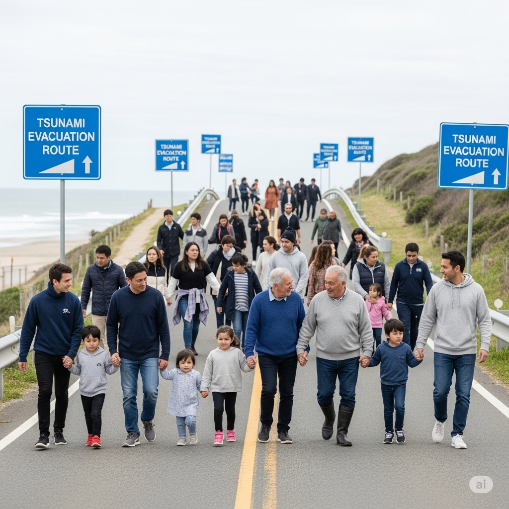
Being Tsunami Ready: Your Role in Safety
While advanced technology plays a critical role, individual and community preparedness is paramount. Here’s how you can be tsunami-ready:
1. Know Your Risk:
- Identify Tsunami Hazard Zones: Find out if your home, workplace, or frequently visited areas are in a tsunami hazard zone. Many coastal communities have maps indicating evacuation routes and safe areas.
- Understand Natural Warnings: Be aware that a strong earthquake, a sudden rise or fall in sea level, or a roar from the ocean are all natural signs of a potential tsunami. If you experience any of these, do not wait for an official alert – evacuate immediately.
2. Make a Plan:
- Emergency Kit: Assemble a portable emergency kit with essentials like water, non-perishable food, first-aid supplies, a flashlight, a NOAA Weather Radio, extra batteries, and any necessary medications.
- Family Communication Plan: Establish how you will contact family members if separated, and designate an out-of-area contact.
- Evacuation Routes: Plan and practice evacuation routes from your home, school, and workplace to high ground or inland areas. Aim for at least 100 feet (30 meters) above sea level or 1 mile (1.6 km) inland if possible. If you can’t go that high or far, go as high or far as you can.
3. Stay Informed:
- Multiple Warning Sources: Have multiple ways to receive official tsunami warnings, such as NOAA Weather Radio, Wireless Emergency Alerts (WEA), local government alerts, and local news broadcasts.
- Monitor Officials: During an event, listen to local officials for updates and instructions.
4. During a Tsunami Threat:
- Drop, Cover, and Hold On: If you are in a coastal area and feel an earthquake, protect yourself from falling objects first.
- Evacuate Immediately: As soon as the shaking stops, move quickly to higher ground or inland. Do not wait for an official warning if you observe natural signs.
- Stay Out of the Water: Even after the initial waves, a tsunami is not a single wave but a series of powerful waves that can last for hours or even a full day. Strong currents can persist. Do not return to coastal areas until officials declare it safe.
5. After a Tsunami:
- Stay Informed: Continue to listen to official updates.
- Assess Damage Safely: Do not enter damaged buildings until deemed safe by professionals. Be wary of downed power lines and contaminated floodwaters.
- Help Others: If it is safe to do so, assist neighbors and those in need.
The Future of Preparedness: A Global Imperative
The increasing frequency and intensity of extreme weather events, coupled with rising sea levels, underscore the critical importance of robust earthquake and tsunami warning systems. The future will likely see:
- Further Integration of Data: Combining seismic, oceanographic, meteorological, and even satellite imagery data for more comprehensive hazard assessment.
- Hyper-Local Warnings: Developing capabilities for highly localized warnings, perhaps down to specific neighborhoods or even buildings, based on micro-zonation and real-time modeling.
- Enhanced Community Resilience Programs: Investing in widespread educational initiatives and drills to ensure communities understand warnings and act decisively, as seen with the active “Tsunami Ready” program.
- International Collaboration: Continued and strengthened international cooperation in data sharing, research, and capacity building, especially for vulnerable nations, which was evident in the coordinated response to the recent Kamchatka earthquake.
Ultimately, the effectiveness of earthquake and tsunami warnings hinges on a synergistic relationship between cutting-edge science, responsive technology, and an informed, prepared populace. By understanding the forces at play and taking proactive steps, we can significantly reduce the impact of these formidable natural disasters, turning seconds of warning into lives saved.